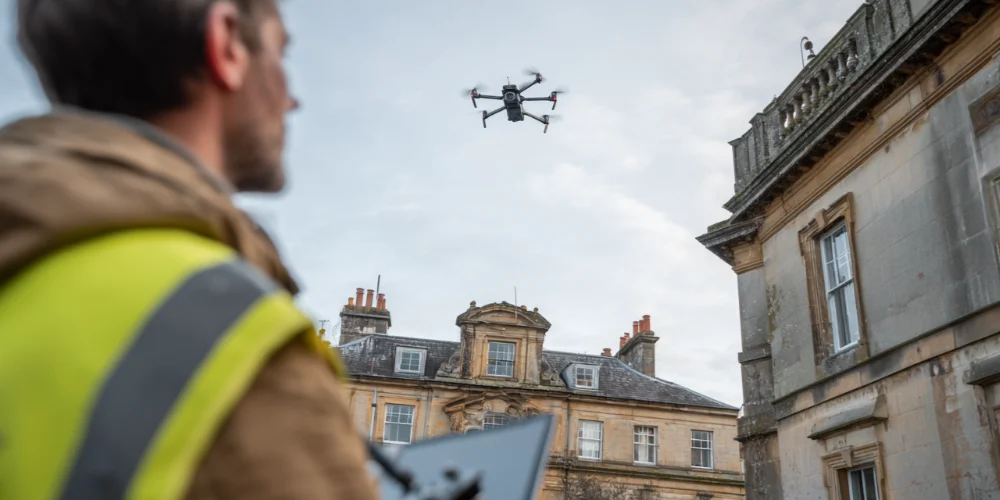
Drone roof surveys in Cheltenham have fundamentally changed how roofs are inspected. They provide detailed visual coverage of the entire roof surface. This includes areas that ladders and scaffolding cannot reach safely. For homeowners, this means a more accurate picture of the roof’s condition. It arrives faster and with significantly less risk.
Across the UK, the adoption of drones for building inspections has grown rapidly. The professional surveying sector now recognises drones as a practical tool for building inspections. The technology delivers reliable, high-resolution data that supports informed decisions.
In Cheltenham, drone roof surveys are particularly valuable. Many properties include Regency parapets, concealed box gutters, and chimney stacks that cannot be assessed from the ground. Historic England notes that parapets and valley gutters often cannot be inspected at ground level. A drone survey provides the high-level assessment needed, without the cost of scaffolding.
This guide explains how drone roof surveys in Cheltenham work and when they are the right choice. To arrange a survey, explore our roof survey services or browse our full range of roofing services.
How Drone Roof Surveys in Cheltenham Work
Planning and Preparation
Before the drone leaves the ground, the operator assesses the site. They identify hazards such as overhead cables, trees, and neighbouring properties. They plan flight paths and check airspace restrictions. The UK Civil Aviation Authority (CAA) classifies drone operations into Open, Specific, and Certified categories. Each has different rules around distance, altitude, and proximity to people. In Cheltenham, airspace planning needs extra attention due to Gloucestershire Airport. Details follow in the airspace section below.
Flight and Data Capture
The drone flies around the property, capturing high-resolution images and video. Our surveys use 4K ultra HD cameras. These identify small defects such as hairline cracks in tiles, early flashing deterioration, and blocked gutter outlets.
The drone covers sections invisible from the ground. It captures chimney stacks from all angles, concealed gutters behind parapets, valley junctions, and flashings at every abutment. For a practical overview, read What to Expect During a Professional Drone Roof Survey.
Analysis and Reporting
After the flight, the operator reviews the data in detail. They produce an annotated report identifying defects, concerns, and recommendations. A typical report covers slipped tiles, failing flashings, blocked gutters, chimney deterioration, and signs of structural movement.
The report also notes limitations. A drone survey is a visual inspection. It identifies surface defects with high accuracy. However, it cannot detect moisture within the roof structure or assess timber condition. Where the visual evidence suggests deeper problems, the report recommends further investigation.
What Drone Roof Surveys Reveal That Other Methods Miss
The Access Advantage
The primary advantage of drone roof surveys in Cheltenham is access. Traditional inspections only cover what a ladder can safely reach. Drones overcome this by providing close-up imagery of every part of the roof.
Problems Invisible From Ground Level
Drones are particularly effective at finding hidden problems. These include hairline cracks in tiles that have not yet displaced. They reveal early-stage flashing failure where the lead has begun to lift. As well as that, they spot blocked gutters behind parapets and chimney defects on the far side. Also, they identify moss accumulation in valleys and behind obstacles.
Our guide on hidden roof damage we found using drone surveys shows real examples. For a broader look, read What Drones See That Homeowners Can’t.
The Benefits of Drone Roof Surveys in Cheltenham
Reduced Risk From Working at Height
The Health and Safety Executive identifies roof work as high-risk. Falls from height and through fragile surfaces cause serious injuries and deaths. Professional safety guidance describes eliminating hazards by substituting methods. Using a drone instead of climbing the roof is a direct example of this principle.
Better Inspection Coverage
Drone imagery covers chimneys, parapet gutters, valleys, dormers, and flat roofs. These areas would otherwise require scaffolding or cherry-picker access. A single visit captures the roof’s full condition.
Faster and Less Disruptive Than Scaffolding
A drone survey typically takes less than an hour. Scaffolding takes days to erect and dismantle. Drones, therefore, make an efficient first step for initial condition assessment. For a simple overview, The Benefits of Drone Roof Surveys covers the key advantages.
Drone Roof Surveys for Heritage and Listed Buildings
Why Drones Suit Period Properties
Cheltenham has a high concentration of heritage properties. Drone roof surveys in Cheltenham are particularly well-suited to inspecting them. Period buildings often have complex rooflines with multiple levels, parapets, and concealed drainage systems. Decorative features can be difficult to access and sensitive to physical contact. Ladders and scaffolding carry a risk of accidental damage to historic fabric. Drones eliminate this risk.
Supporting Planning and Conservation Submissions
Drone surveys also help document a heritage roof’s condition. This is useful for planning applications and conservation area submissions. Cheltenham’s planning context creates higher scrutiny over external changes. Drone surveys often gather the evidence needed to support decisions about repair methods and materials. For more, read The Benefits of Drone Roof Surveys for Heritage and Listed Buildings.
Drone Roof Surveys for Home Buyers
What Standard Surveys Miss
If you are buying a property, drone roof surveys in Cheltenham provide information that standard surveys cannot. RICS home surveys (Level 2 and Level 3) only cover what the surveyor can safely access. The Level 3 scope limits roof-space inspection to 3 metres above floor level. Surveyors do not open up the building fabric. The external roof covering, chimneys, and concealed drainage may receive limited assessment on taller buildings.
A Practical Add-On for Buyers
A drone survey expands the visual evidence available. It identifies defects on the external roof surface that would otherwise go unrecorded. This gives buyers better information for negotiation. Our guide on what surveyors look for on your roof during a house sale explains where the gaps typically are.
How We Use Drones to Improve Repair Accuracy
Diagnosis Before Access
Accurate diagnosis is the foundation of effective repair. When a contractor sees exactly what is wrong before starting work, they target the repair correctly. They specify the right materials. They define the scope before anyone gets on the roof.
Reducing Guesswork
Without a drone survey, diagnosis relies on a ground-level visual check. This misses defects on the far side of the roof, around chimneys, in valleys, and behind parapets. We use drone data as the starting point for repair planning. The 4K imagery locates every visible defect before work begins. For example, read How We Use Drones to Improve Roof Repair Accuracy. You can also see results in our case studies. If a survey identifies problems, address them through our roof repair services.
Airspace Rules and Legal Requirements
UK-Wide Regulations
The Civil Aviation Authority regulates drone use in the UK. Operators must hold the correct registrations (Flyer ID and Operator ID). They must operate within their drone category rules. They must maintain a visual line of sight and stay within altitude limits.
Gloucestershire Airport Flight Restriction Zone
Cheltenham sits close to Gloucestershire Airport. This means Flight Restriction Zones (FRZ) apply. The CAA defines an FRZ as an area where you cannot fly without permission. Gloucestershire Airport publishes a specific process for drone operations nearby. Submit applications at least five days before the planned flight. This means drone roof surveys in Cheltenham require planning in many areas. A qualified operator handles all of this as standard.
Privacy and Data Protection
Drone surveys capture images and video. This can include views of neighbouring properties. The Information Commissioner’s Office provides guidance for organisations using drones for video surveillance. This covers lawful data collection, privacy, and secure handling of captured information.
A professional operator manages privacy compliance as standard. They inform neighbours where appropriate. They handle all data in accordance with UK data protection law.
Safety Advantages of Drone Roof Surveys
The safety case for drone roof surveys in Cheltenham is straightforward. Every minute a person spends on a roof is a minute of fall risk. Drones remove this exposure entirely for the inspection phase.
The HSE identifies falls from roofs and through fragile surfaces as major causes of death. Using a drone to inspect the roof first means that when a contractor does go up for repairs, they know exactly what they face. They can plan the safest access method accordingly. This benefits homeowners, too. Nobody needs to climb your roof just to tell you what is wrong with it.
What Homeowners Should Do Next
If your property has not had a roof inspection recently, drone roof surveys in Cheltenham may be the most effective next step. They provide a clear, detailed picture without unnecessary risk or cost. Drone surveys also work well as part of a regular maintenance programme. They are valuable as pre-purchase inspections and condition records for insurance.
If you want to arrange a survey, contact us. You can also read our reviews to see how other property owners rate the service. Acting early allows you to identify and resolve problems before they become serious and expensive.
Frequently Asked Questions About Drone Roof Surveys in Cheltenham
How long does a drone roof survey take?
A typical drone roof survey takes less than an hour on site. This includes the pre-flight site assessment, the flight itself, and packing up. The operator then reviews the footage and produces an annotated report, which is usually delivered within a few working days.
What can a drone roof survey detect?
Drone surveys identify surface defects with high accuracy. These include slipped or cracked tiles, failing flashings, blocked gutters, chimney deterioration, moss build-up, and signs of structural movement. However, a drone survey is a visual inspection. It cannot detect moisture within the roof structure or assess the condition of timbers beneath the surface.
Do I need permission for a drone to fly over my property in Cheltenham?
The property owner or occupier should give consent for the survey. The drone operator handles all regulatory requirements, including CAA compliance. In Cheltenham, parts of the town fall within the Gloucestershire Airport Flight Restriction Zone. A professional operator will apply for the necessary permissions at least five days before the flight.
Are drone roof surveys suitable for listed buildings?
Yes. Drone surveys are particularly well-suited to listed and heritage buildings. They provide detailed visual inspection without any physical contact with the building fabric, eliminating the risk of accidental damage. They are also useful for documenting roof condition as part of planning applications or conservation area submissions.
Can a drone survey replace a traditional roof inspection?
A drone survey provides better coverage of the external roof surface than most traditional inspections. It captures areas that ladders and scaffolding cannot safely reach. However, it does not replace a loft inspection, moisture testing, or structural assessment. For a comprehensive picture, combine a drone survey with an internal inspection where possible.